Q plotter compatible with Navionics nautical charts – Know your waters
Did you know that Q plotters are compatible with Navionics nautical charts? The Navionics cartography helps you to better understand the lakes and marine areas where you sail this summer, especially in the Finnish ans Swedish lakes and waters.
The collaboration was announced back in November 2019, and has since been a part of the Q Experience. ”Navionics cartography integration is an important achievement in our product roadmap to enhance the boating experience,” said Johan Wessberg, Nextfour CTO in November, when the new nautical charts were made available. ”Navionics fresh and feature-rich cartography perfectly suits our offering, and it allows us to publish exciting new navigation features.”
Nautical charts of Finnish and Swedish lakes on your Q plotter
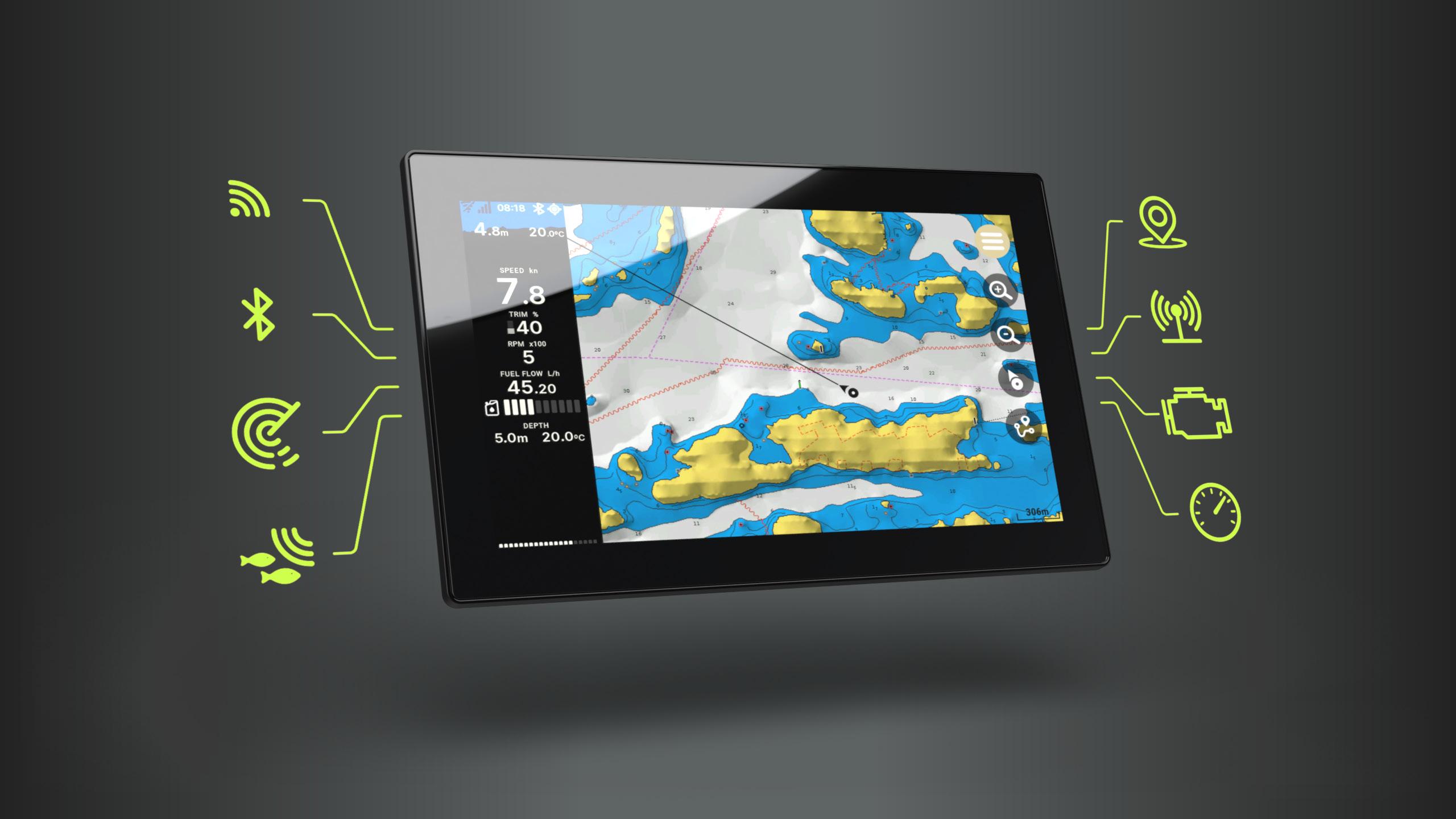
With the collaboration between Nextfour and Navionics, the nautical charts and features have been able to reach thousands of more boaters. The maps can be used to study port plans and safety depth of the waters, as well as identify tides and currents. It also enables the user to locate navigation aids and nearby marine services.
“We are very happy to see more boat owners able to access valuable Navionics cartography through our new compatibility with Nextfour devices.”
Marcello Albanese, Navionics director of sales and business development.
Navionics cartography enables the users of the Q plotters to explore new navigation features. One of the most awaited and used features is the cartography of Swedish and Finnish lakes. With Navionics it is easier to navigate your way through these lands and their thousands of lakes.
Q Experience, designed and manufactured by Nextfour, is factory-installed on boats brands such as Yamarin, Cross, and Buster. Brand names like Yamarin Q, Cross Q, Buster Q, Askeladden C-Command etc. are all part of the Q experience, and can use the Navionics nautical chart features.
How do I get the nautical maps on my Q plotter?
Navionics Nautical Charts can be bought as a year-long subscription. You can select the needed nautical area such as Swedish lakes, or the Gulf of Finland, from their subscription page. Follow their directions on getting the charts on your devices.
If you are a new customer you have to choose the right card type for your plotter. Here’s a manual on how to activate your Navionics card. If you already have the Navionics card in your plotter, there’s a built-in activation of the charts you have subscribed to. If you have any problems on activating your subscription to Navionics, check their Support-page here.
New Navionics features to come
Currently the collaboration between the Q Experience and Navionics gives users a chance to access Navionics cartography, and other selected features. New features, such as mobile-syncing with the Q plotter, are coming in the near future!