1944.564
- Support for Navionics+ Gold and Platinum maritime charts. NOTE: Depending of the display’s age it might need to download the Navionics background map from our cloud server. For this, internet connection (WLAN/mobile) is needed.
- Completely redesigned Radio application is now Music! It allows you to control music from all of your sources, including FM/DAB radio and Bluetooth. In multi-display installation most of the Music app features can now be controlled from any Q screen in your boat.
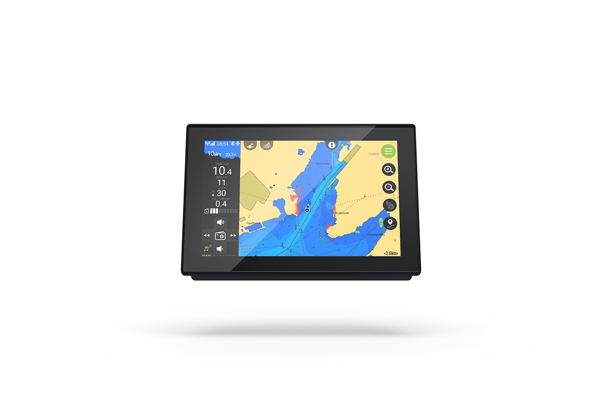
- New autozoom feature in Navigation app. The application zooms automatically closer when your speed is lower and zooms back to default zoom level when you increase speed. The feature is on by default, you can enable/disable it from Settings > Navigation > Automatic zoom speed.
- New trim calibration feature allows you to calibrate your trim to show percentage between 0-100%. You can run the calibration from Settings > Boat > Engine trim calibration.
- New service log feature allows you to keep track of your services. Manage your service log from Settings > Boat > Service info. Service reminder is enabled for specific boat brands, to remind about approaching/due routine services.
- Readiness for the new Q Mobile App, available for all boat brands which do not have their own dedicated mobile application. Stay tuned for further news in the near future!
- Boat icon on the chart does not display heading anymore when it is not available. This occurs when e.g. heading is obtained from GPS and the boat is not moving.
- Support for custom route coloring. Change the color and transparency by editing the route from My Routes menu.
- Support for custom trail coloring. Change the color and transparency from Settings > Navigation > Route recording color.
- Changed Man-overboard (MOB) function to more generic “mark current place” function. Drop place mark to the current position with the utility button menu’s leftmost button in the navigator.
- If the GPS fix is lost for some reason the last known location of the boat is now shown as a question mark on the chart.
- New settings: Settings > Boat draft/beam/height. Affects for automatic route finding feature.
- Boat position lock button functionality in the Navigation app changed a bit. Now, the second press sets the zoom level to the default (configurable from Settings > Navigation > Default zoom level).
- Support for one engine – two fuel tanks -setup.
- Navigation chart specific settings moved from Settings > Navigation to Settings > Navigation > Navigation chart settings.
- New setting: Settings > Navigation > Safe water depth. When the setting Settings > Navigation > Coloring is set to “safe” this setting is available. It controls the depth limit which the navigation chart uses for drawing the water in safe color (i.e. not darker blue). The default is 10 meters.
- New setting: Settings > System > Manual shutdown. When enabling this setting the automatic display power off is disabled. The display can be powered off by pressing the new power off button in the bottom of the main menu (only enabled when the ignition is off) or by setting ignition on and off again.
- New setting: Settings > Boat > AIS MSSI. This setting is only visible when AIS is connected (when AIS sources detected). This setting is valid only when having AIS sender installed to prevent own boat displayed as AIS source.
- Fixes for C-MAP marine chart’s text rendering issue.