Q infotainment plotters are compatible with Navionics+ and Platinum+ map charts.
Navionics charts help you to better navigate through different waters with detailed cartography for marine and lakes.
You can select the coverage area of your charts to fit your boating needs, like e.g. Swedish lakes, Italian coasts, or the Åland Islands.
You can read more about Navionics and get your subscription from here.
Downloading Navionics to your card
If you have trouble updating your card or have technical issues, connect our Q Support at q-support@nextfour.com.
How to start using Navionics with your SD card?
To unlock all features and functions of your card you’ll need to activate it first and get a subscription. There’s no need to put the card to your plotter before activating it. The activating happens on your computer.
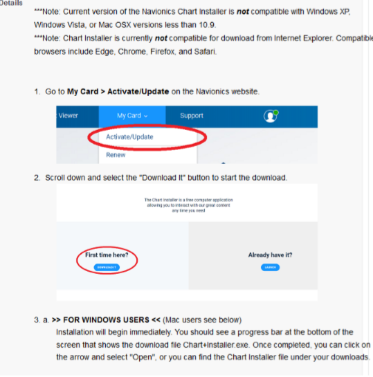
1. Download and install the Chart Installer Program
First, you’ll need to install the Chart Installer Program to your computer. Install it to your computer from this link. You’ll find the download link under the “First time here?” section (see image below).
2. Sign-in and plug the SD card in
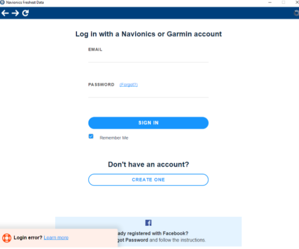
Once you have installed the Chart Installer, open it on your computer.
Sign in with your Navionics/Garmin account.
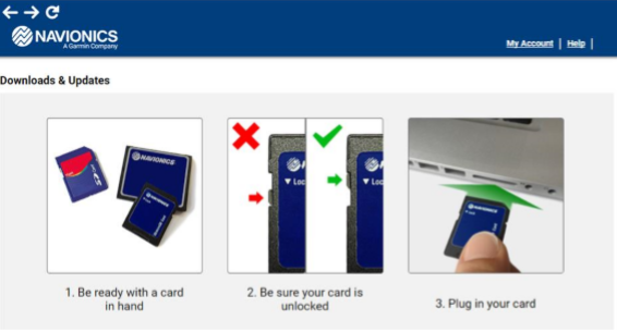
When you have signed in, you can plug your SD card to your computer. Make sure the card is unlocked (see the image below).
3. Choose your plotter and charts
When the SD card is plugged in to your computer, choose your plotter brand from the list on the left. You’ll find them from the “Built-in Plotters” selection on the bottom of the Step 1 -section.
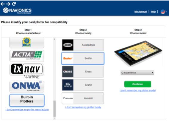
When you have chosen the right plotter brand, you can choose the charts you want to download.
When the right region is selected click Continue. Confirm your choice by clicking I Agree.
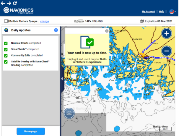
After this you’ll get a “Your card is now up to date” info box on your screen.
Do not remove the SD card until you get this confirmation, or the download will not be completed.
7. Insert the SD card in to your Q plotter
When the download is completed, you can unplug the SD card from your computer and insert it into your Q-unit.
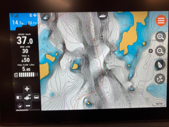
You can activate the depth contours from Settings > Navigation > Navigation chart settings > Sonarchart.
Your map should look something like this: